GOVERNMENT OF INDIAGOVERNMENT OF INDIA
A Digital India Initiative

Smart Maps Dharamshala

September 20, 2019

Project Summary

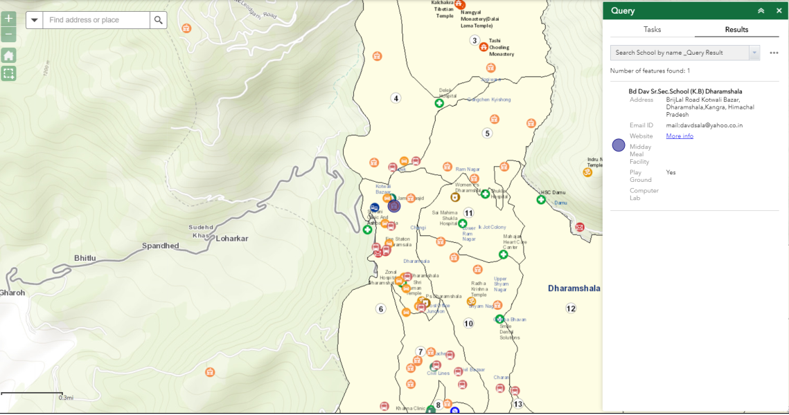
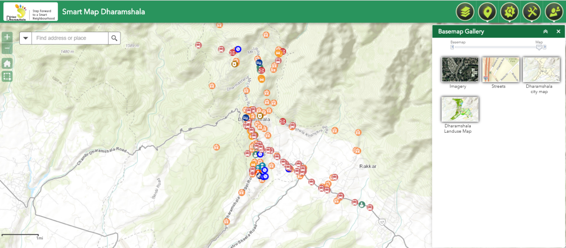
Smart Map Dharamshala is a GIS Portal created as a part of Smart City Project of Dharamshala. The main aim of creating the portal was to bring the different spatial components of the city into one platform for providing location intelligence details to different stakeholders of the city for a common decision making for the city and also to provide spatial information about spatial features of the city to residents and to Tourists.

The Maps cater to the government agencies to deliver location-based services and information and to undertake a multi-agency collaboration with many government agencies currently participating and contributing information. This e-platform can be used to find locations, ward information, information on public services, updated notifications from various Govt. organizations, location and significance of different tourist sites, event calendar of Dharamshala City and much more. The portal updates the data on a regular basis and more government departments are partnered for a better service delivery and to have a one stop solution for each resident of Dharamshala.

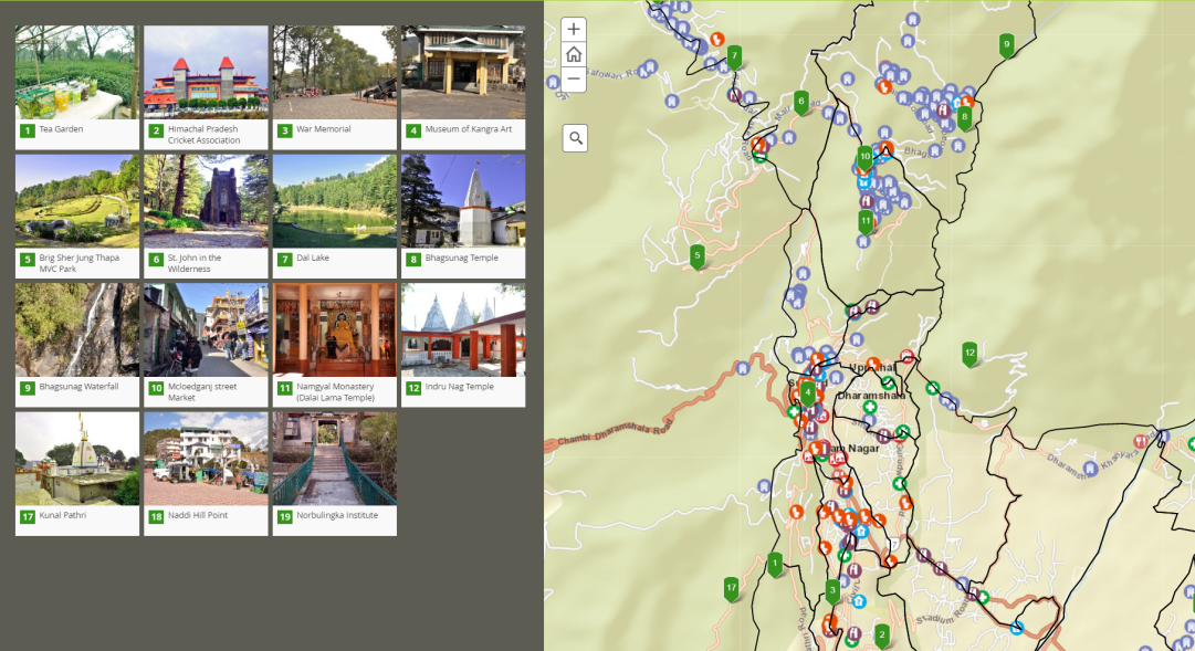
Along with it, Dharamshala being a tourist town, the mainstay of the people is tourism. There is a requirement of information, whereby the people may plan the tour with map based information.

Challenges

The most important challenge today any city in India is facing is the lack of communication among the different stakeholders in the city for a common decision support system. Along with that the City authorities face challenge in terms of location of their assets and properties. For converting a Dharamshala city into smart City the basic challenges were to understand:

  1. The geographical setup or the urban environment as it is hilly town and has special requirement in compare to towns in plains.
  2. The citizens need to be aware of the different facilities in the city with the details like the school and it’s performance, the financial services available in the city, the health facilities, the market facilities etc. In absence of the knowledge of facilities the citizens cannot take intelligent decisions.
  3. For planning the smart integrations, one need to know the existing roads, the proposed locations of cameras for surveillance, the coverage of the cameras.

Solution

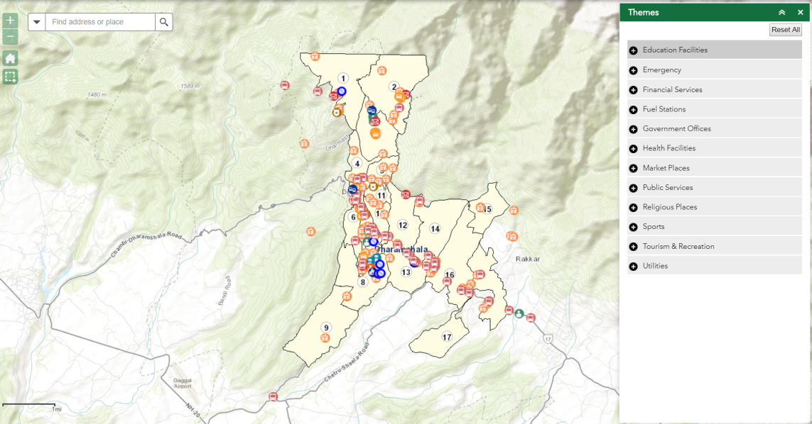
The SmartMapDharamshala provides the following to the city authorities and citizens:

  1. The location-based intelligence through various spatial layers includes:
    1. Education Facilities
    2. Emergency services
    3. Financial Services
    4. Fuel Station
    5. Government offices
    6. Health facilities
    7. Market places
    8. Public services
    9. Religious Places
    10. Sports Facilities
    11. Tourism and recreation
    12. Utilities
  2. Different types of queries are customised for the citizens
    • Search School by name
    • Search hospital by ambulance availability
    • Search government office by name
    • Search bank by name
    • Search ATM by locality
  3. Ward Info: This provides details of ward corporations, the officials responsible for the ward administration, the population details of the wards, number of education institutes and health centres in the wards
  4. The other functionalities in the portal includes the buffering of facilities around me, geolocated events in the city and tourism points location.
  5. The tools include draw, mark location, measurement print and share information on social media.

The GIS based e-portal helps in providing information to the citizens and administration making them location-intelligent. Esri got associated with the Dharamshala SPV for development of Phase I of City Portal. Esri successfully created, launched and leveraged the existing readily available data model, maps and application for further configuration, enhancement & maintenance in order to cater the requirement of intelligent city operations and management centre (ICOMC) RFP with respect to GIS architecture, high availability, Active-Active solution requirement, incremental growth of usage and application load and maintenance.

Key Benefits:

  • Common Communication Language of different departments and stakeholders involved in the city administration.
  • The Story map for the Dharamshala tourism and information of the nearest bank, restaurant, hotel etc. around that tourist point. This help in mobilization of the tourist.
  • The Layers of Roads, Water, Sewer, Storm Water, POIs will be used for the integration with the smart Components. It will also help in optimising the location of Smart Components for the coverage of the services.
  • GIS is the common platform, where all the smart components will be integrated inside the Command and Control Room in future.

  • The success of Smart City depends on the smart services to the citizens. And the GIS platform offers,          information on different areas of interest in the city, like Nearest Schools, Hospitals, Police stations. It helps to find the places of tourist interest and the route guide to reach there. It also helps the citizen in knowing the details of their ward and provide access to different officials responsible for the ward. The e-portal also has provision for registering the grievance through the Feedback forms. It also enables the citizens to add any event in the city and to share it on social media
top