Smart Map Bhopal
September 20, 2019
Author:
jitendra_singh_rathore
Challenge
While planning for a smart city, the most important challenge the city authorities face are to know “what is where?” , “what is the condition, spread and coverage?”, and “where is the gap”. The answer to these question derive the first step of planning. “What should be”. For converting a city into a smart city the basic challenges are to understand:
- The necessity of different components and their locations, like roads and traffic, surveillance points, location of existing schools, hospitals, police stations, ATMs etc.
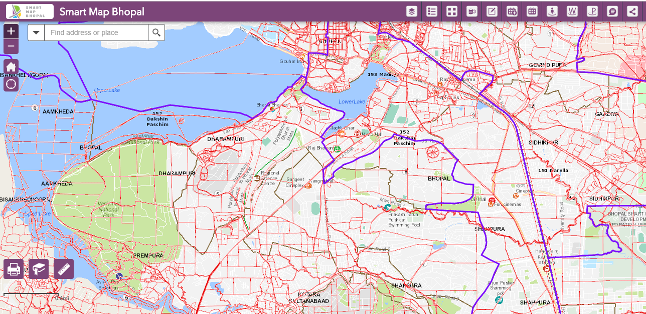
- Jurisdictions of different agencies in the city, like Police Beats, Health districts, Development Authority’s boundaries, Municipal Corporation’s boundaries, the Revenue boundaries, the Assembly constituencies, the DMAs.
- For planning the smart integrations, one need to know the existing roads, the proposed locations of cameras for surveillance, and the coverage of the cameras. For water supply one needs to know the existing sources of water supply in the city, the coverage of piped water network, the existing DMAs and water supply etc.
Solution
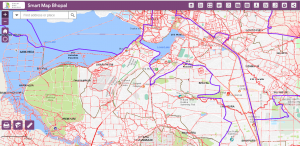
Smart Map Bhopal is envisioned as a city level GIS portal that will act as a one-stop destination for citizens, businesses and government departments to discover, consume and share information about Bhopal. Smart Map Bhopal, a web application that seamlessly functions across various devices has been developed using the Esri ArcGIS, a leading GIS software that provides unique set of capabilities for applying location-based analysis.
It is a platform where all departments can contribute their set of available data and information and bring it at one place which can then be used by various departments. The Layers have been clubbed/clustered according to the utility of that layer. Following Layers are there in the City Portal:
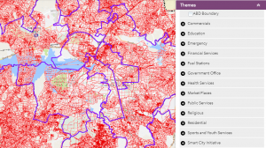
- Building: Vidhan Sabha, Village boundary, Ward Boundary, Zone Boundary, BMC boundary, Planning Boundaries and ABD Areas.
- Commercial : In Commercial the different automobile industries, Business houses, Industries, Commercial Building, Godown and Workshops location are clubbed.
- Education: College, learning institutes, Libraries, University, School and Engineering Colleges are depicted in separate layers.
- Emergency: The Police Station and Fire Brigades are marked as the preparation for any incident of emergency.
- Financial Services: The Financial Companies, Insurance companies, ATMs and Banks feature in this layer.
- Fuel stations in GIS may support any citizen searching nearby Petrol Pumps and gas statin
- Offices cluster Government offices, ward offices and Zone offices.
- Health Layer has medical stores, medical facilities, Hospitals, Dispensaries and clinics
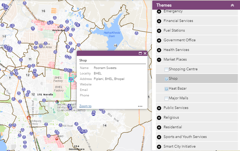
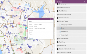
- Market places encompasses shopping centres, shops, Haat Bazars and Major Malls.
- Public services layer is for the community services catering to Poor like, Toilets, Rainbaseras, fitness centres- Gyms, Parking, Community halls, Builders in Bhopal, ATP, Snake Catchers, She Lounges, Shiv Neer.
- Religious layers is for location of temples, Mosques, Churches and Ashrams.
- Residential areas include apartment building s and hostels.
- Sports and Youth provide spatial location for sport stadiums and Swimming pools
- The Layer of Smart Initiatives include the facilities which are created for making the city smart including the Smart City Offices, Smart Cycle Stands, Cycle Path, Smart Poles, Location of Cameras.
- Transportation involves bus stops up and down, Railway station, Railway Line, Airway and Roads
- Tourism and recreation layer provides the location-based intelligence on Cinema Halls, Hotels, Restaurants, Clubs, Recreation centres, scenic places and Bars.
- Utility layers provide a vivid variety of Utility like Water Tank, Electricity Substation, Solid Waste Dumping Yards, BMC Stores, Street Lights poles, Street Light Meters, and containers for waste disposal.
- Looking at the ongoing demand for Land Rights, the Urban Poor housing is marked as a separate layer consisting of location of slums, Rajeev Awas Yojna, and basic services for urban poor.
These Layers, on one hand help the citizens in locating the various services through the layers or through various tools and on the other support governments in planning and decision making.
As part of the solution an unprecedented array of information such as Ward Info, Know Your plot, Around Me, Queries and Themes have been developed to enable citizens of Bhopal to be aware of the public amenities and infrastructure related components available for them in the city.
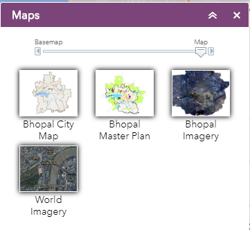
The Base map gallery functionality in the solution provides citizens with different map data representations of Bhopal to view and scrutinize. The solution is a great avenue for the citizens to truly participate by providing feedbacks and report their grievances.

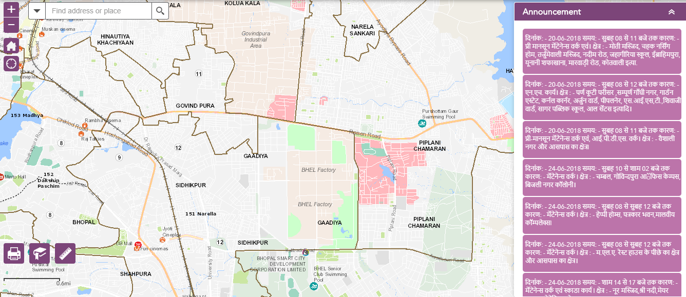
Smart Map Bhopal solution also ensures that citizens are kept updated about the latest events happening in their city and also enter their own public events to be a part of the listed events in the application.
To promote the rich heritage of Bhopal, a unique and interactive Story map template has been used to allow citizens to explore goelocation information, images and descriptions of Bhopal’s heritage sites, museums, gates and lakes.
Key Benefits:
- It provides a common platform for interaction between different departments and stakeholders involved in the smart city and city administration.
- It provides a birds eye view of the different components of planning of the city, the different planning boundaries, the underlaying cadastral boundaries, the comprehensive proposed plan. The Layers of conservation as per Archeological survey of India and the NOC maps of Airport Authority of India, regarding Height regulations. These information together provides planning inputs for the Smart City.
- The Layers of Roads, Water, Sewer, Storm Water, POIs will be used for the integration with the smart Components. It will also help in optimising the location of Smart Components for the coverage of the services.
- GIS is the common platform, where all the smart components will be integrated inside the Command and Control Room in future.
- The success of a Smart City depends on the smart services to the citizens. And the GIS platform offers, information on different areas of interest in the city, like Nearest Schools, Hospitals, Police stations. It helps to find the places of tourist interest and the route guide to reach there. It also helps the citizen in knowing the details of their ward and provide access to different officials responsible for the ward. The e-portal also has provision for registering the grievance through the Feedback forms.
 GOVERNMENT
OF INDIA
GOVERNMENT
OF INDIA