GOVERNMENT
OF INDIA
GOVERNMENT
OF INDIA
A Digital India Initiative
GOVERNMENT
OF INDIA


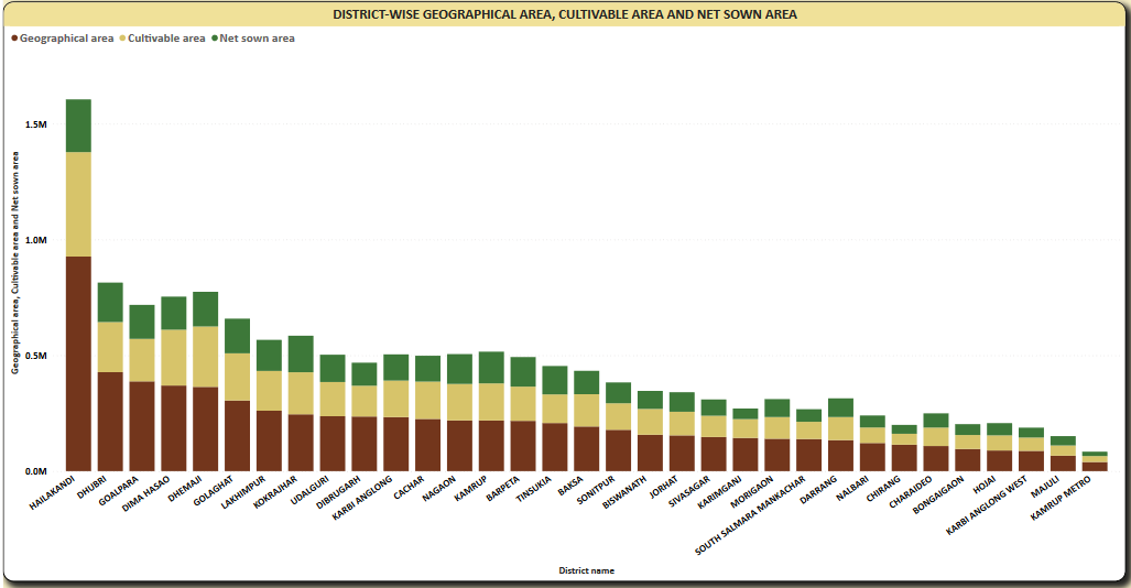
The Graph shows District-wise Geographical Area, Cultivable area and Net Sown Area. Highest Geographical Area is of District Hailakandi and the lowest Geographical Area is of Kampur Metro. Highest Cultivable area is of District Hailakandi and the lowest is of Kampur Metro. Geographical area and Total Cultivable Area are Postively correlated with each other. Hailakandi accounted for 12.88% of Geographical area. Across all 33 District name, Geographical area ranged from 39669 to 927021, Cultivable area ranged from 25455 to 450881, and Net sown area ranged from 19026 to 227880.