BhubaneswarOne – A single platform for providing location-based intelligence
October 28, 2019
Author:
Seshadev Panda
Project Summary
BhubaneshwarOne is a GIS Portal created as a part of Smart City Project of Bhubaneswar. The portal aims to bring the different spatial components of the city into a single platform for providing location-based intelligence details to different stakeholders for common decision making, and also to provide information about spatial features of the city to residents and tourists.
The Maps cater to government agencies for delivering location-based services, and enable multi-agency collaboration with the government agencies currently participating in and contributing information. This e-platform can be used to find locations, ward information, information on public services, updated notifications from various Govt. organizations, location of different tourist sites, event calendar of Bhubaneswar City and much more. The portal updates the data on a regular basis and more government departments are partnered for a better service delivery and to have a one-stop solution for each resident of Bhubaneswar.
Challenges
While planning for a smart city, key challenges the city authorities face are to know “what is where?” , “what is the condition, spread and coverage?”, and “where is the gap”. The answer to these questions is the first step of planning “What should be”. For converting a city into a smart city the basic challenges are to understand:
-
- The necessity of different components and their locations, like roads and traffic, surveillance points, location of existing schools, hospitals, police stations, ATMs etc.
- Jurisdictions of different agencies in the city, like police beats, health districts, Development authority’s boundaries, municipal corporation’s boundaries, the revenue boundaries, the Assembly constituencies, the DMAs.
- For planning the smart integrations, one needs to know the existing roads, the proposed locations of cameras for surveillance, the coverage of the cameras. For water supply one needs to know the existing sources of water supply in the city, the coverage of piped water network, the existing DMAs and water supply etc.
Solution
The BhubaneshwarOne portal provides the following to the city authorities and citizens:
1. The portal provides the following layers of information:
-
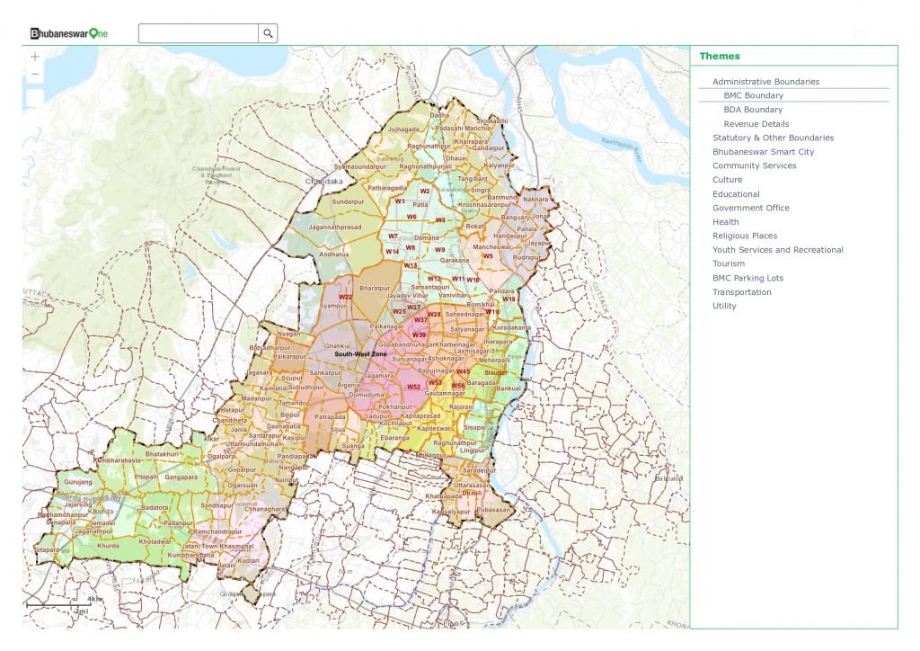
- The administrative boundaries
- Bhubaneswar Municipal Corporations Boundary, the Zone boundaries and Ward Boundaries.
- Bhubaneswar Development Authorities Boundaries, the Planning zone boundaries.
- The revenue details: Village/Mouza boundary and the plots.
-
- The Other Planning Boundaries
- Comprehensive development plan of Bhubaneswar.
- The BDA Town Planning Schemes- declared and proposed.
- The Assembly Constituency Boundary.
- The Airport Authority of India Zone map.
- The ASI protected, prohibited and regulated areas.
- The Police jurisdiction.
- The Health Jurisdiction.
- The ABD area of Smart City.
-
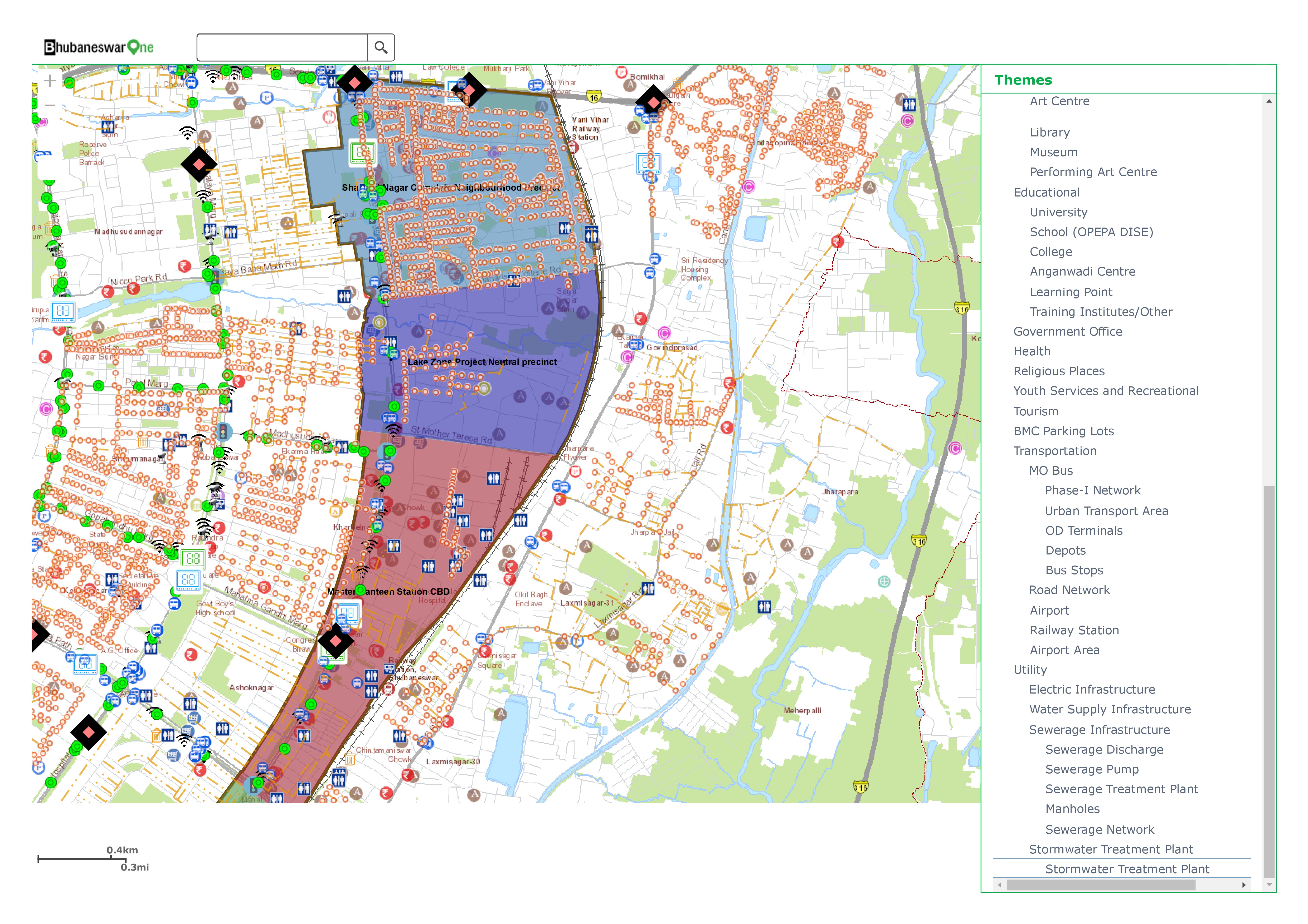
- The Community services like police station and outposts, The post offices, banks, hotels, restaurants, petrol pumps, community centers, fire stations, shopping places and telephone exchanges.
- Art Center, Library, Museum and Performing arts centers.
- The different hierarchies of education institutes and skill centers and training institutes.
- The different hierarchy of government and private health facilities and Anganwadis.
- The religious places.
- The Sports recreation and youth activity centers and parks.
- The different type of Tourist places and heritage sites.
- The transport network includes different hierarchies of roads, bus stops and flyovers; airport and Railway station.
- The Utility layers includes electricity network, water supply network and water meters, the sewage network and discharge locations and storm water treatment plant.
2. Different types of queries are customized for the citizens
-
- Ward Corporator’s name
- Ward Population
- Location of school by name
- The location of public health centers by name
- The location of type of Anganwadi centers.
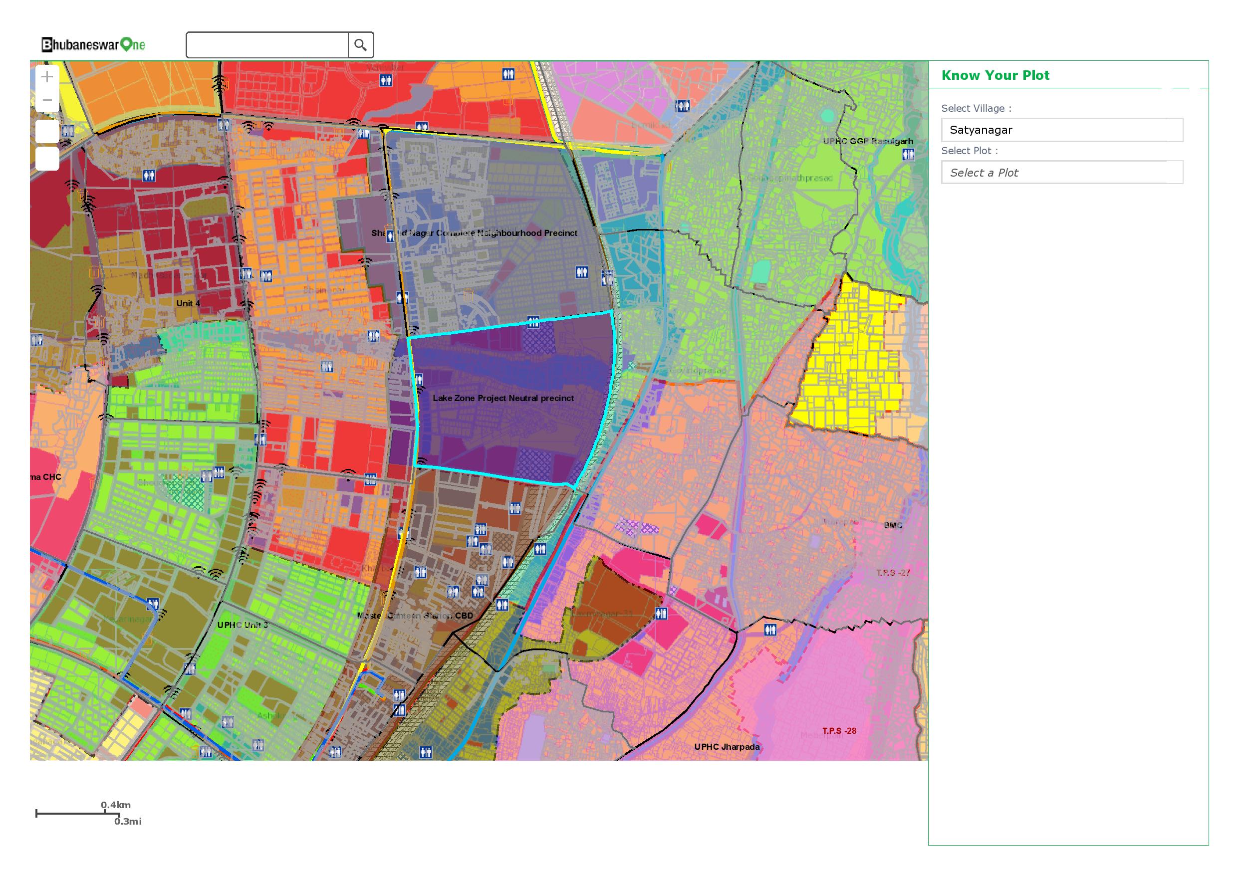
3. Know your plot functionality helps in searching the cadastral plots in a particular village, the details show the current ownership and area of the plot along with current land use and land use code.
4. Know your wards, provides the details of ward corporation, the officials responsible for the ward administration, the population details of the wards, number of education institutes and health centers in the wards.
5. The other functionalities in the portal include buffering of facilities around me, geo-located events in the city, announcements (if any) for public with geolocations, posting feedback/grievance from any location; and heritage points location.
6. There is also facility to draw over the map and share it in social sites.
The GIS based e-portal helps in planning the city for a Smart City. Esri got associated with the Bhubaneswar SPV for development of Phase I of City Portal. Esri successfully created, launched and leveraged the existing readily available data model, maps and application for further configuration, enhancement and maintenance in order to cater the requirement of Intelligent City Operations and Management Center (ICOMC) RFP with respect to GIS architecture, high availability, Active-Active solution requirement, incremental growth of usage and application load and maintenance.
Key Benefits
- It provides a common platform for interaction between different departments and stakeholders involved in the smart city and city administration.
- It provides a bird’s eye view of the different components of planning of the city, the different planning boundaries, the underlying cadastral boundaries, and the comprehensive proposed plan. The Layers of conservation as per Archaeological Survey of India and the NOC maps of Airport Authority of India, regarding height regulations. These information together provides planning inputs for the Smart City.
- The Layers of Roads, Water, Sewer, Storm Water, POIs will be used for the integration with the smart components. It will also help in optimizing the location of smart components for the coverage of the services.
- GIS is the common platform, where all the smart components will be integrated inside the Command and Control Room in future.
- The success of Smart City depends on the smart services to the citizens. And the GIS platform offers, information on different areas of interest in the city, like Nearest Schools, Hospitals, Police stations. It helps to find the places of tourist interest and the route guide to reach there. It also helps the citizen in knowing the details of their ward and provide access to different officials responsible for the ward. The e-portal also has provision for registering the grievance through the Feedback forms.
 GOVERNMENT
OF INDIA
GOVERNMENT
OF INDIA


